
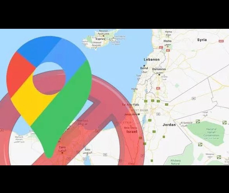
Recently a controversial string of tweets hit Twitterverse claiming that Google has removed the label for Palestine from its global mapping and GPS service Google maps. The truth is a little different from what the twitterattis wanted us to see.
If one searches Palestine on maps, it pans to the area and doesn’t show a label while clearly labeling Israel right next to it. While 136 UN members recognize Palestine as an independent state. The West as a collective led by the US mostly does not.
As more people took notice of the tweet by Palestinian journalists, the hashtag #PalestineIsHere started trending and multiple statements condemning Google came from all over the world.
A Google spokesperson in response to the complaint said “There has never been a ‘Palestine’ label on Google Maps, however we discovered a bug that removed the labels for ‘West Bank’ and ‘Gaza Strip’. We’re working quickly to bring these labels back to the area.”
This reflects to a deeper problem deeply embedded in the conflict between Israel and Palestine. While Israel received its status of an independent country in the year 1948, Palestine still struggles in gaining that very same status. A petition from March this year which urged Google to give Palestine its own label gained traction with almost 250,000 people signed already and the number is rising.
While all of this does not effect the physical boundaries in any way, this particular issue has pointed out another larger issue of how technology can be used to drive public opinion and create a false perspective in the long run.

Caitlyn Dewey, a senior journalist and analyst for Washington Post recently commented on this particular issue saying “In their attempts to dispassionately document the physical world online, tech companies often end up shaping our understanding of it, too. That’s not something that we tend to think about often, but it does become pretty obvious when a map changes/is said to have changed, or when we compare different maps against each other.”
A fact to note is that this is not the first time Google maps has gotten the borders of disputed territories wrong and the chance of it being the last are slim. In 2014 a group of researchers documented how Google Maps attempts to stay out of geographical disputes and issues pertaining to national identity.
The prime example of this is Crimea, where users in Russia see it as a part of Russian territory with a solid line across the border and users outside of Russia see the border surrounded by dashed line, a common indication of an occupied territory or a shifting border.